


Nord du Mont Lozère

ilur56
User

Length
9.1 km

Max alt
1699 m

Uphill gradient
239 m
Km-Effort
12.5 km

Min alt
1411 m

Downhill gradient
304 m
Boucle
No
Creation date :
2015-09-02 00:00:00.0
Updated on :
2015-09-02 00:00:00.0
2h37
Difficulty : Easy

FREE GPS app for hiking
 SityTrail
IGN / Geographical institutes
SityTrail Plus
The world is yours!
About
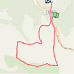
Trail Walking of 9.1 km to be discovered at Occitania, Lozère, Mont Lozère et Goulet. This trail is proposed by ilur56.
Positioning
Country:
France
Region :
Occitania
Department/Province :
Lozère
Municipality :
Mont Lozère et Goulet
Location:
Mas-d'Orcières
Start:(Dec)
Start:(UTM)
559508 ; 4921590 (31T) N.
Comments